
If you happen to find yourself hiking in snow-covered areas of Northwest mountains this summer, you may come across a strange sight — large stretches of pinkish red snow. This phenomenon, sometimes referred to as “watermelon snow,” is not as benign as it sounds. In the warm summer months, there is more water present between ice crystals in snow, providing habitat for snow algae to grow. These snow algae protect themselves from intense solar radiation by developing pigments that give the snow a reddish hue. While clean, white snow surfaces reflect almost all incoming solar radiation — helping protect our atmosphere from warming — snow darkened with algae absorbs heat that would otherwise be reflected, causing it to melt more quickly.
Snowmelt is an important source of freshwater, recharging streams and rivers in the dry summer months, and sustaining Tribes, species, and other human and non-human communities until the rains return in the fall. However, when the timing and quantity of snowmelt shifts, it can affect water availability for these downstream communities. Since snow algae is expected to become more widespread as the climate warms, it’s important to understand how snow algae will affect our Northwest snowpack and water availability into the future.
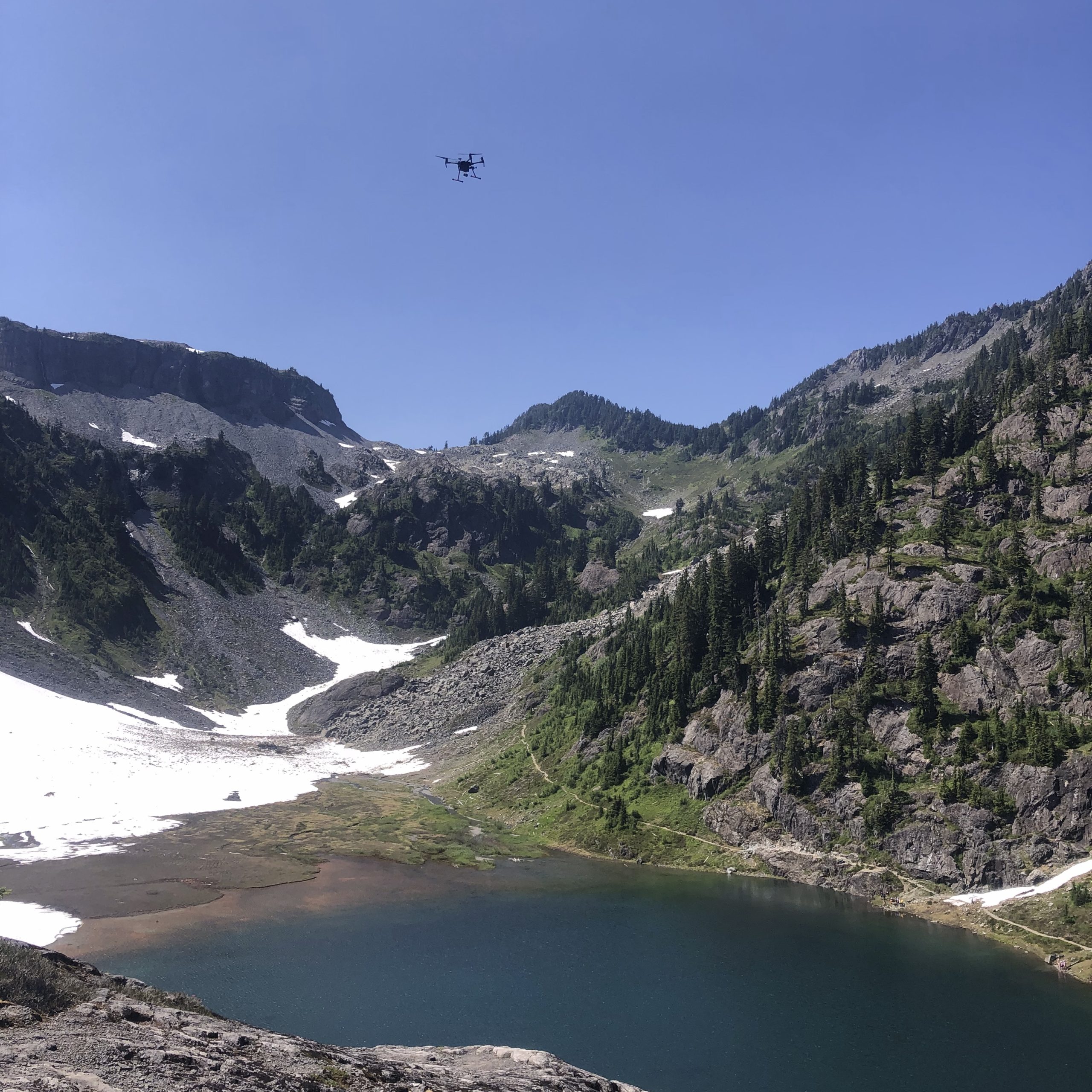
Until recently, it’s been difficult to study how snow algae affects the timing and quantity of snowmelt in remote and inaccessible areas. To address this challenge, 2020 NW CASC Research Fellow Shannon Healy and colleagues tested remote sensing approaches for mapping snow algae distribution in the North Cascades using unmanned aerial vehicles (UAVs).
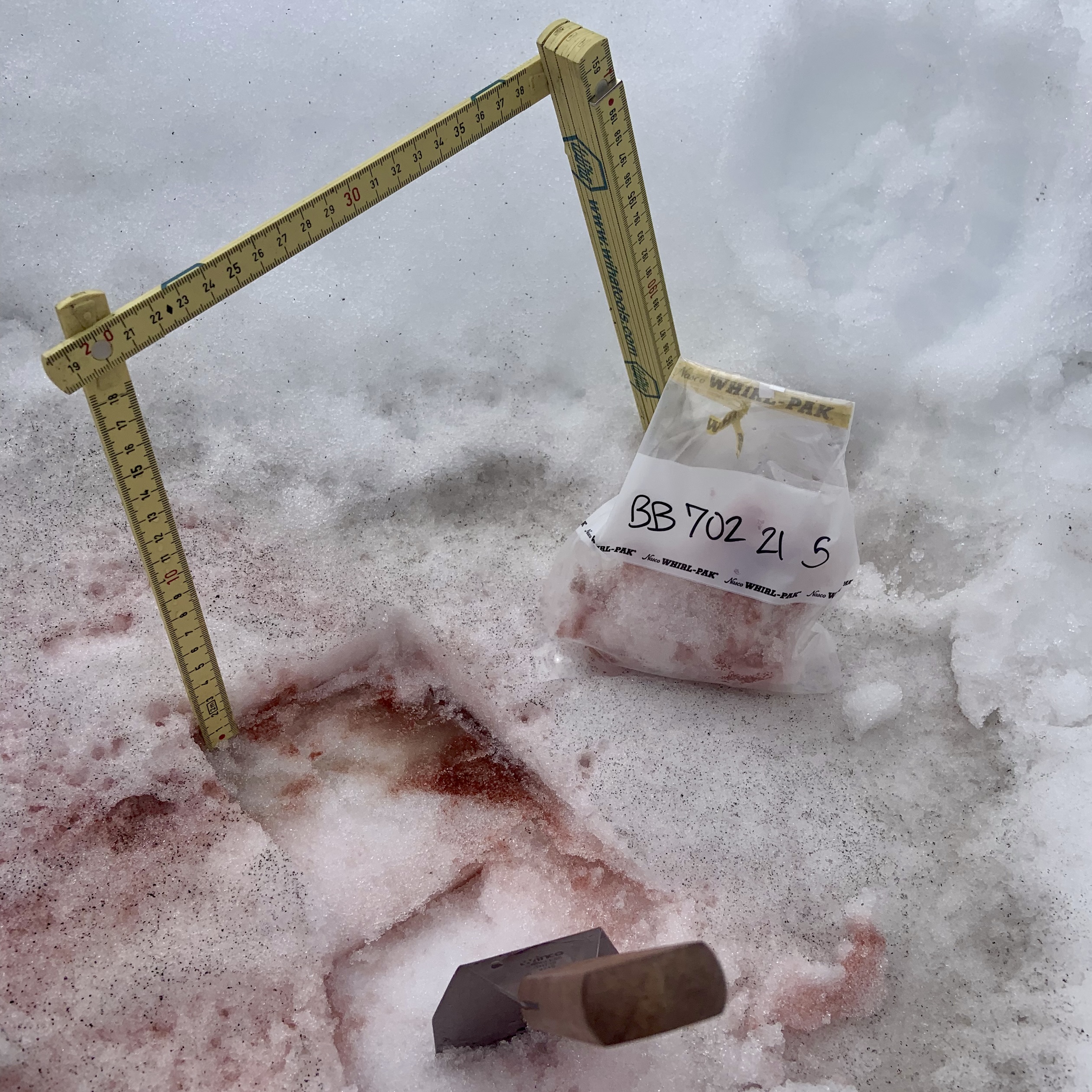
This study was conducted on the alpine glaciers of the Bagley Basin in Washington’s North Cascades. The snowmelt-fed Bagley Lakes flow into a tributary that leads to the North Fork Nooksack River. Since time immemorial, local Tribes have relied on the snowmelt from the Bagley Lakes Basin to replenish the river in the rain-scarce summer months and support salmon populations. The Nooksack River also provides drinking water and water for irrigation in the region. The research team chose this study site because it’s accessible by foot, offering a unique opportunity to collect physical snow samples to ground truth the data collected in aerial surveys.
Though satellite images have been used to remotely detect snow algae in rugged and inaccessible sites, they are limited in their ability to detect light wavelengths and spatial data at fine resolutions. Recognizing a need for new approaches to more accurately map snow algae, Shannon Healy and colleagues tested methods for collecting snow algae data using camera systems attached to UAVS. In recent years, UAVs have become more widely available and affordable, making them an exciting and accessible tool for research.
In the summer and fall of 2021, this research team conducted three survey flights of the Bagley Lakes basin to test remote sensing approaches for mapping snow algae. They used a multispectral camera system, which captures a wide spectrum of light at fine spatial scales, attached to a UAV, to map snow algae in the Bagley Basin. The first two flights collected data during the summertime snow algae bloom, while the third survey in the fall captured elevation data from the snow-free basin. After each aerial survey, the research team collected ground samples of varying bloom intensities across the study area to validate the data collected with the UAVs.

Researchers used two approaches to collect snow data from the UAVs. The first approach, a Principal Component Analysis (a type of analysis that reduces the dimensions in large datasets), allowed researchers to use all of the 10 spectral bands of data to extract precise snow algae coverage from other spectrally unique features like rock, water and vegetation. As a second approach, researchers used spectral indexing (a classification approach that uses ratios of specific spectral bands to detect snow algae) to draw out snow algae data from snow. In the first survey, both approaches provided clear separation between snow algae and the rest of the snowpack. In the second survey, the separation between snow and algae was less distinct. This difference in separation effectiveness was attributed to the peak in bloom intensity during the first survey, detected from the associated ground samples, which provided greater spectral contrast between the clean snow and the red snow algae.
The research team combined the UAV mapping results with the physical samples taken after each flight to calculate the snowmelt caused by snow algae in the study area that summer. This study demonstrated the ability to remotely detect and map snow algae in mid-latitudes using UAVs carrying a multispectral camera. It also revealed that remote detection of snow algae works best during periods of greater bloom intensity. In the North Cascades, snow algae will continue to influence the timing of peak snowmelt and should be considered in regional watershed melt models. The advances in collecting snow algae and mapping its distribution can support adaptation strategies to manage and preserve our water resources as the climate changes, both in the Northwest, as well as other mountain ranges experiencing snow algae in the spring and summer, such as the Colorado Rockies and the Sierra Nevada.